20 farmers, 18 male and 2 female, in crisp mundu and sari respectively, arrive in small groups by 9.30 a.m. at Thanal’s agroecology centre in Thirunelly Panchayat, Wayanad, a district in northern Kerala. Arun R S, working in organic and natural farming at Thanal, passes around recycled pencil and paper and says to the group, “We want to be able to learn from each other, let’s start by writing down the problems we face in our fields and we will find solutions for it.”
Historically an Adivasi district, Wayanad, from Vayal Nadu, implies a paddy field in Malayalam. So farmers here are rice-growers, who also sow cash crops like ginger, cardamom, coffee, tea, vanilla and pepper. Agriculture, mixed with forest and a little bit of tourism, is the economic heartbeat here. But with the rising cost of chemical inputs and constant fluctuation in the international price of produce, farmers’ income and well-being has been greatly affected for decades. Between 2003-2007 alone, Wayanad had some of the highest numbers of farmer suicides in Kerala. In 2004, when 130 farmers committed suicide, Thanal, an organisation focused on environmental awareness, started work alongside farmers to restore income and land. This project in turn became the agroecology centre in Wayanad in 2009. By 2010, a Rice Diversity Block was started with 4 native paddy varieties.
As of October 2021, they have conserved approximately 300+ traditional varieties, out of which 180 are from Kerala. Arun takes the 20 strong groups for a hands-on session to make cow dung-based biopesticide. Workshops like these help rethink biomass quality and focus on the whole agri-lifecycle from seed to soil. Sudha chechi (Malayalam for sister, often used when referring to older women), working with Thanal as a farm caretaker, facilitates communication between farmers and the local tribal residents. Farmers reach out to her with questions like, “what medicine can be used to protect cardamom leaves from worm attacks?” Sudha, with her knowledge of medicinal plants and their uses, tries to provide solutions.
Thanal confronts micro-queries and shows actual proof of change. What if they also collated data and made it available in a completely different part of the world, useful for conservation research as well? Thanal’s website is rich with information, but what if data modelling can empower each of their farmers to upload data directly?
Restor, a collaborative effort between Google and the Crowther Lab at ETH Zurich, is an organisation collecting data from such micro-movements and locations, to create models. Their website pitch is, “accelerating the global restoration movement by connecting everyone, everywhere to local restoration. Restor connects people to scientific data, supply chains, funding, and each other to increase the impact, scale, and sustainability of restoration efforts.”
How is this done? The land is mapped using GIS, short for Geographic Information Systems. This allows a user to convert their patch of flat land or agri-field into a beautiful, multi-layered map right from their computer, using GIS software such as QGIS or ArcGIS. 24 year Giacomo Delgado who has been working in Switzerland’s Zurich HQ of Restor as a community and outreach associate for several months now, says, “We are creating state of the art models, as well as pulling best in class models created by other organizations (e.g. Environmental Systems Research Institute (ESRI)’s land cover map).”
But is this software accessible to a common farmer or conservationist? “QGIS is being widely used across the country by NGOs and common people. ArcGIS is very expensive and is often only made available at universities,” says Dr. Divya Vasudev, co-founder of Conservation Initiatives, a Guwahati based Indian not-for-profit trust, working towards conservation since 2017.

An example of a Remote Sensed image of a piece of land. The top image shows a normal picture, the middle image is infrared and the bottom image shows an image with elevation information.
“Visual Remote Sensing” by NOAA’s National Ocean Service is licensed under CC BY 2.0
Advancing Internet access and GIS software becoming more advanced, open access, easy to use and in some cases, free or reasonable, has made it possible for Restor to collect data from 72,500 sites across the globe, as of October 15, 2021.
Restor went public this October 13, by making its data and tools available to all, for free. Nyguthi Chege, an executive director at Kenya’s Green belt movement, says, “with this tool, we can easily determine which species are native to a region and assess the carbon that different ecosystems can store. Information that is so important to get restoration projects over initial hurdles and realize our vision.”
What can this mean for the Wayanad farmers and the agroecology centre working with them? Arun can now draw a boundary in the satellite map for farms transitioning to organic farming. He can then update the database with their restoration status, ownership and intervention type. Conservationists and farmers across the globe can observe how the farm changes over a period of three years and learn from it.
Is it a whole new world wide web, especially for those individuals and communities isolated by access, distance or movement until now? The politics of data ownership, modelling access and ease of use is unfolding in real-time as case histories.
The field is yet, open.
Cefil is a student of Mathematics and Environmental Studies at Ashoka University.
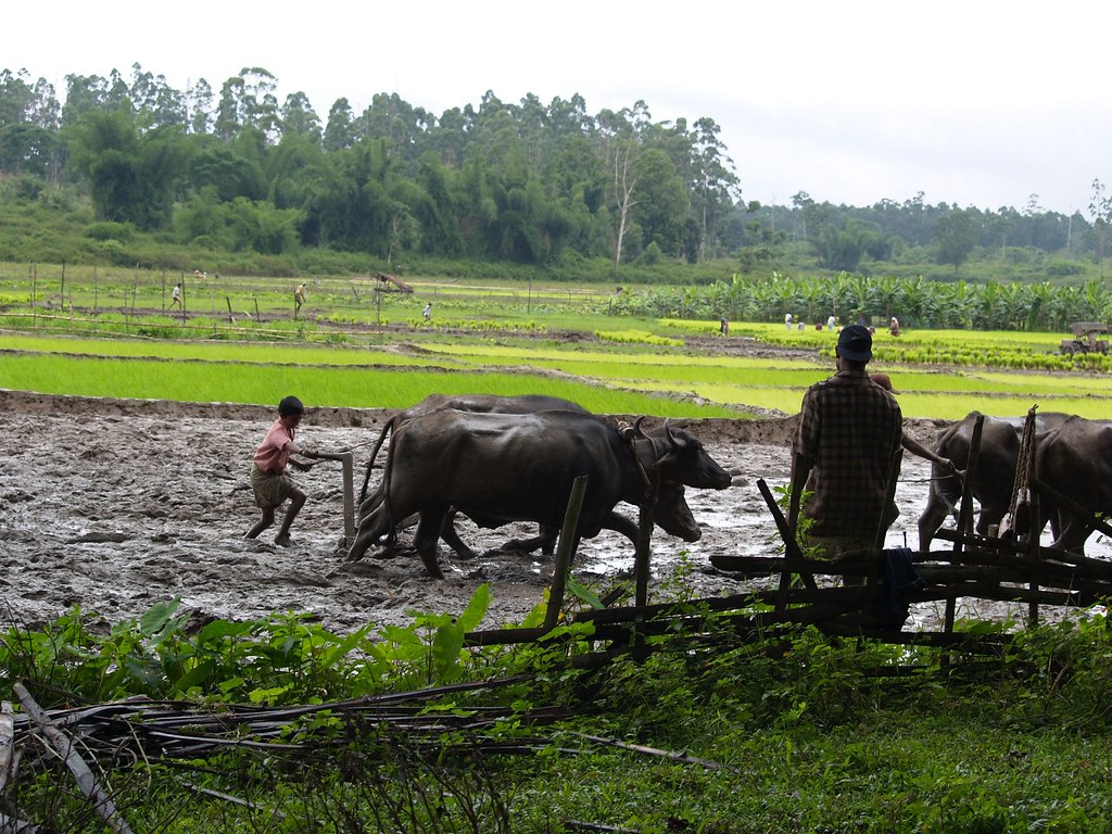
The featured image is by dhruvaraj, licensed under CC BY 2.0.
We publish all articles under a Creative Commons Attribution-NoDerivatives license. This means any news organisation, blog, website, newspaper or newsletter can republish our pieces for free, provided they attribute the original source (OpenAxis).

One reply on “From Zurich to Wayanad, Can The Data Modelling Highway Restore Farmer Science and Soil?”
Excellent thought
LikeLike